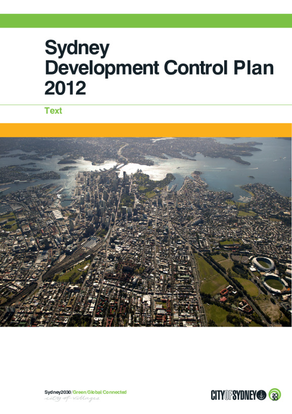
Sydney Development Control Plan 2012
For development where the City of Sydney Council and Central Sydney Planning Committee is the consent authority, Sydney DCP 2012 applies.
Published

New employment zones
In our local environment plans new employment zones began on 26 April 2023.
Any mention of a former industrial or business zone in our other planning documents, including development control plans, is legally taken to be a mention of the new employment zones.
For more details on these reforms visit the Department of Planning, Housing and Infrastructure website. To see the new employment zones, view the 'equivalent zone tables' under resources.
Table of contents and glossary of termsPDF · 806.15 KB · Last modified
Section 1: IntroductionPDF · 3.14 MB · Last modified
Section 2: Locality statementsPDF · 12.88 MB · Last modified
Section 3: General provisionsPDF · 23.04 MB · Last modified
Section 4: Development typesPDF · 1.15 MB · Last modified
Section 5: Specific areasPDF · 38.59 MB · Last modified
Section 6: Specific sitesPDF · 32.96 MB · Last modified
SchedulesPDF · 2.12 MB · Last modified
Development guidelines: Boarding houses (including student accommodation)PDF · 2.15 MB · Last modified
Development guidelines: Child care centresPDF · 112.67 KB · Last modified
Development guidelines: Sex industry and adult entertainment premisesPDF · 1.17 MB · Last modified
Related documents
Alternative natural ventilation of apartments in noisy environments: Performance pathway guideline (draft)PDF · 2.42 MB · Last modified
Landscape code (volume 1): Single dwellingsPDF · 2.59 MB · Last modified
Landscape code (volume 2): All development except single dwellingsPDF · 6.45 MB · Last modified
Minimising overshadowing of neighbouring apartments: Documentation guidelines (draft)PDF · 7.51 MB · Last modified
Minimising overshadowing of neighbouring apartments: Excel data tables (draft)XLSX · 153.07 KB · Last modified
Map sheets
- Sheet 001: Active frontages map – Not applicable
- Sheet 001: Building contributions map
- Sheet 001: Building height in storeys map
- Sheet 001: Building setback and alignment map – Not applicable
- Sheet 001: Building street frontage height in storeys map – Not applicable
- Sheet 001: Entertainment sound management
- Sheet 001: Footpath, awnings and colonnades map
- Sheet 001: Late night trading areas map – Not applicable
- Sheet 001: Pedestrian priority map
- Sheet 001: Proposed open space map – Not applicable
- Sheet 001: Public domain setbacks map – Not applicable
- Sheet 001: Signage precincts map – Not applicable
- Sheet 001: Stormwater management map – Not applicable
- Sheet 001: Streets and lanes map – Not applicable
- Sheet 001: Through-site links map – Not applicable
- Sheet 002: Active frontages map
- Sheet 002: Building contributions map
- Sheet 002: Building height in storeys map
- Sheet 002: Building setback and alignment map – Not applicable
- Sheet 002: Building street frontage height in storeys map
- Sheet 002: Entertainment sound management
- Sheet 002: Footpath, awnings and colonnades map
- Sheet 002: Late night trading areas map
- Sheet 002: Pedestrian priority map
- Sheet 002: Proposed open space map – Not applicable
- Sheet 002: Public domain setbacks map – Not applicable
- Sheet 002: Signage precincts map
- Sheet 002: Stormwater management map
- Sheet 002: Streets and lanes map – Not applicable
- Sheet 002: Through-site links map – Not applicable
- Sheet 003: Active Frontages Map
- Sheet 003: Building contributions map
- Sheet 003: Building height in storeys map
- Sheet 003: Building setback and alignment map
- Sheet 003: Building street frontage height in storeys map
- Sheet 003: Entertainment sound management
- Sheet 003: Footpath, awnings, and colonnades map
- Sheet 003: Late night trading areas map
- Sheet 003: Pedestrian priority map
- Sheet 003: Proposed open space map – Not applicable
- Sheet 003: Public domain setbacks map – Not applicable
- Sheet 003: Signage precincts map
- Sheet 003: Stormwater management map
- Sheet 003: Streets and lanes map
- Sheet 003: Through-site links map – Not applicable
- Sheet 004: Active frontages map – Not applicable
- Sheet 004: Building contributions map
- Sheet 004: Building height in storeys map
- Sheet 004: Building setback and alignment map
- Sheet 004: Building street frontage height in storeys map
- Sheet 004: Entertainment sound management
- Sheet 004: Footpath, awnings and colonnades map
- Sheet 004: Late night trading areas map
- Sheet 004: Pedestrian priority map
- Sheet 004: Proposed open space map
- Sheet 004: Public domain setbacks map – Not applicable
- Sheet 004: Signage precincts map
- Sheet 004: Stormwater management map
- Sheet 004: Streets and lanes map
- Sheet 004: Through-site links maps
- Sheet 005: Active street frontages map – Not applicable
- Sheet 005: Building contributions map – Not applicable
- Sheet 005: Building height in storeys map
- Sheet 005: Building setback and alignment map
- Sheet 005: Building street frontage height in storeys map – Not applicable
- Sheet 005: Entertainment sound management – Not applicable
- Sheet 005: Footpath, awnings and colonnades map – Not applicable
- Sheet 005: Late night trading areas map – Not applicable
- Sheet 005: Pedestrian priority map – Not applicable
- Sheet 005: Proposed open space map
- Sheet 005: Public domain setbacks map
- Sheet 005: Signage precincts map – Not applicable
- Sheet 005: Stormwater management map
- Sheet 005: Streets and lanes map
- Sheet 005: Through-site links maps
No information available.
- Sheet 007: Active frontages map
- Sheet 007: Building contributions map
- Sheet 007: Building height in storeys map
- Sheet 007: Building setback and alignment map
- Sheet 007: Building street frontage height in storeys map
- Sheet 007: Entertainment sound management
- Sheet 007: Footpath, awnings and colonnades map
- Sheet 007: Late night trading areas map
- Sheet 007: Pedestrian priority map
- Sheet 007: Proposed open space map – Not applicable
- Sheet 007: Public domain setbacks map – Not applicable
- Sheet 007: Signage precincts map
- Sheet 007: Stormwater management map – Not applicable
- Sheet 007: Streets and lanes map – Not applicable
- Sheet 007: Through-site links map – Not applicable
- Sheet 008: Active frontages map
- Sheet 008: Building contributions map
- Sheet 008: Building height in storeys map
- Sheet 008: Building setback and alignment map
- Sheet 008: Building street frontage height in storeys map
- Sheet 008: Entertainment sound management
- Sheet 008: Footpath, awnings and colonnades map
- Sheet 008: Late night trading areas map
- Sheet 008: Pedestrian priority map
- Sheet 008: Proposed open space map – Not applicable
- Sheet 008: Public domain setbacks map – Not applicable
- Sheet 008: Signage precincts map
- Sheet 008: Stormwater management map
- Sheet 008: Streets and lanes map – Not applicable
- Sheet 008: Through-site links map – Not applicable
- Sheet 009: Active frontages map
- Sheet 009: Building contributions map
- Sheet 009: Building height in storeys map
- Sheet 009: Building setback and alignment map – Not applicable
- Sheet 009: Building street frontage height in storeys map
- Sheet 009: Entertainment sound management
- Sheet 009: Footpath, awnings and colonnades map
- Sheet 009: Late night trading areas
- Sheet 009: Pedestrian priority map
- Sheet 009: Proposed open space map – Not applicable
- Sheet 009: Public domain setbacks map – Not applicable
- Sheet 009: Signage precincts map
- Sheet 009: Stormwater management map
- Sheet 009: Streets and lanes map – Not applicable
- Sheet 009: Through-site links map – Not applicable
- Sheet 010: Active frontages map
- Sheet 010: Building contributions map
- Sheet 010: Building height in storeys map
- Sheet 010: Building setback and alignment map
- Sheet 010: Building street frontage height in storeys map
- Sheet 010: Entertainment sound management
- Sheet 010: Footpath, awnings and colonnades map
- Sheet 010: Late night trading areas map
- Sheet 010: Pedestrian priority map
- Sheet 010: Proposed open space map
- Sheet 010: Public domain setbacks map
- Sheet 010: Signage precincts map
- Sheet 010: Stormwater management map
- Sheet 010: Streets and lanes map
- Sheet 010: Through-site links map
- Sheet 011: Active frontages map
- Sheet 011: Building contributions map
- Sheet 011: Building height in storeys map
- Sheet 011: Building setback and alignment map
- Sheet 011: Building street frontage height in storeys map
- Sheet 011: Entertainment sound management – Not applicable
- Sheet 011: Footpath, awnings and colonnades map
- Sheet 011: Late night trading areas map
- Sheet 011: Pedestrian priority map
- Sheet 011: Proposed open space map
- Sheet 011: Public domain setbacks map
- Sheet 011: Signage precincts map
- Sheet 011: Stormwater management map
- Sheet 011: Streets and lanes map
- Sheet 011: Through-site links map
- Sheet 012: Active frontages map
- Sheet 012: Building contributions map – Not applicable
- Sheet 012: Building height in storeys map
- Sheet 012: Building setback and alignment map
- Sheet 012: Building street frontage height in storeys map
- Sheet 012: Entertainment sound management – Not applicable
- Sheet 012: Footpath, awnings and colonnades map
- Sheet 012: Late night trading areas map – Not applicable
- Sheet 012: Pedestrian priority map – Not applicable
- Sheet 012: Proposed open space map
- Sheet 012: Public domain setbacks map
- Sheet 012: Signage precincts map – Not applicable
- Sheet 012: Stormwater management map
- Sheet 012: Streets and lanes map
- Sheet 012: Through-site links map
- Sheet 013: Active frontages map
- Sheet 013: Building contributions map
- Sheet 013: Building height in storeys map – Not applicable
- Sheet 013: Building setback and alignment map – Not applicable
- Sheet 013: Building street frontage height in storeys map – Not applicable
- Sheet 013: Entertainment sound management
- Sheet 013: Footpath, awnings and colonnades map – Not applicable
- Sheet 013: Late night trading areas map
- Sheet 013: Pedestrian priority map
- Sheet 013: Proposed open space map – Not applicable
- Sheet 013: Public domain setbacks map – Not applicable
- Sheet 013: Signage precincts map
- Sheet 013: Stormwater management map – Not applicable
- Sheet 013: Streets and lanes map – Not applicable
- Sheet 013: Through-site links map – Not applicable
- Sheet 014: Active frontages map
- Sheet 014: Building contributions map
- Sheet 014: Building height in storeys map
- Sheet 014: Building setback and alignment map – Not applicable
- Sheet 014: Building street frontage height in storeys map – Not applicable
- Sheet 014: Entertainment sound management
- Sheet 014: Footpath, awnings and colonnades map
- Sheet 014: Late night trading areas map
- Sheet 014: Pedestrian priority map
- Sheet 014: Proposed open space map – Not applicable
- Sheet 014: Public domain setbacks map – Not applicable
- Sheet 014: Signage precincts map
- Sheet 014: Stormwater management map – Not applicable
- Sheet 014: Streets and lanes map
- Sheet 014: Through-site links map
- Sheet 015: Active frontages map
- Sheet 015: Building contributions map
- Sheet 015: Building height in storeys map
- Sheet 015: Alternative building height in storeys map
- Sheet 015: Building setback and alignment map – Not applicable
- Sheet 015: Building street frontage height in storeys map
- Sheet 015: Alternative building street frontage height in storeys map
- Sheet 015: Entertainment sound management
- Sheet 015: Footpath, awnings and colonnades map
- Sheet 015: Late night trading areas map
- Sheet 015: Pedestrian priority map
- Sheet 015: Proposed open space map
- Sheet 015: Public domain setbacks map – Not applicable
- Sheet 015: Signage precincts map
- Sheet 015: Stormwater management map – Not applicable
- Sheet 015: Streets and lanes map
- Sheet 015: Through-site links map
- Sheet 016: Active frontages map
- Sheet 016: Building contributions map
- Sheet 016: Building height in storeys map
- Sheet 016: Building setback and alignment map
- Sheet 016: Building street frontage height in storeys map
- Sheet 016: Entertainment sound management
- Sheet 016: Footpath, awnings and colonnades map
- Sheet 016: Late night trading areas
- Sheet 016: Pedestrian priority map
- Sheet 016: Proposed open space map – Not applicable
- Sheet 016: Public domain setbacks map
- Sheet 016: Signage precincts map
- Sheet 016: Stormwater management map – Not applicable
- Sheet 016: Streets and lanes map
- Sheet 016: Through-site links map
- Sheet 017: Active frontages map
- Sheet 017: Building contributions map
- Sheet 017: Building height in storeys map
- Sheet 017: Building setback and alignment map
- Sheet 017: Building street frontage height in storeys map
- Sheet 017: Entertainment sound management
- Sheet 017: Footpath, awnings and colonnades map
- Sheet 017: Late night trading areas map
- Sheet 017: Pedestrian priority map
- Sheet 017: Proposed open space map
- Sheet 017: Public domain setbacks map
- Sheet 017: Signage precincts map
- Sheet 017: Stormwater management map
- Sheet 017: Streets and lanes map
- Sheet 017: Through-site links map
- Sheet 018: Active frontages map
- Sheet 018: Building contributions map
- Sheet 018: Building height in storeys map
- Sheet 018: Building setback and alignment map
- Sheet 018: Building street frontage height in storeys map
- Sheet 018: Entertainment sound management – Not applicable
- Sheet 018: Footpath, awnings and colonnades map
- Sheet 018: Late night trading areas map
- Sheet 018: Pedestrian priority map – Not applicable
- Sheet 018: Proposed open space map
- Sheet 018: Public domain setbacks map
- Sheet 018: Signage precincts map
- Sheet 018: Stormwater management map
- Sheet 018: Streets and lanes map
- Sheet 018: Through-site links map
- Sheet 019: Active frontages map
- Sheet 019: Building contributions map – Not applicable
- Sheet 019: Building height in storeys map
- Sheet 019: Building setback and alignment map
- Sheet 019: Building street frontage height in storeys map
- Sheet 019: Entertainment sound management – Not applicable
- Sheet 019: Footpath, awnings and colonnades map
- Sheet 019: Late night trading areas map – Not applicable
- Sheet 019: Pedestrian priority map – Not applicable
- Sheet 019: Proposed open space map
- Sheet 019: Public domain set backs map
- Sheet 019: Signage precincts map – Not applicable
- Sheet 019: Stormwater management map
- Sheet 019: Streets and lanes map
- Sheet 019: Through-site links map
No information available.
- Sheet 021: Active frontages map
- Sheet 021: Building contributions map
- Sheet 021: Building height in storeys map
- Sheet 021: Building setback and alignment map
- Sheet 021: Building street frontage height in storeys map
- Sheet 021: Entertainment sound management
- Sheet 021: Footpath, awnings and colonnades map
- Sheet 021: Late night trading areas map
- Sheet 021: Pedestrian priority map – Not applicable
- Sheet 021: Proposed open space map – Not applicable
- Sheet 021: Public domain setbacks map – Not applicable
- Sheet 021: Signage precincts map – Not applicable
- Sheet 021: Stormwater management map – Not applicable
- Sheet 021: Streets and lanes map – Not applicable
- Sheet 021: Through-site links map – Not applicable
- Sheet 022: Active frontages map
- Sheet 022: Building contributions map
- Sheet 022: Building height in storeys map
- Sheet 022: Alternative building height in storeys map
- Sheet 022: Building setback and alignment map
- Sheet 022: Building street frontage height in storeys map
- Sheet 022: Alternative building street frontage height in storeys map
- Sheet 022: Entertainment sound management
- Sheet 022: Footpath, awnings and colonnades map
- Sheet 022: Late night trading areas map
- Sheet 022: Pedestrian priority map
- Sheet 022: Proposed open space map – Not applicable
- Sheet 022: Public domain setbacks map – Not applicable
- Sheet 022: Signage precincts map
- Sheet 022: Stormwater management map – Not applicable
- Sheet 022: Streets and lanes map – Not applicable
- Sheet 022: Through-site links map
- Sheet 023: Active frontages map
- Sheet 023: Building contributions map
- Sheet 023: Building height in storeys map
- Sheet 023: Alternative building height in storeys map
- Sheet 023: Building setback and alignment map – Not applicable
- Sheet 023: Building street frontage height in storeys map
- Sheet 023: Alternative building street frontage height in storeys map
- Sheet 023: Entertainment sound management
- Sheet 023: Footpath, awnings and colonnades map
- Sheet 023: Late night trading areas map
- Sheet 023: Pedestrian priority map
- Sheet 023: Proposed open space map – Not applicable
- Sheet 023: Public domain setbacks map – Not applicable
- Sheet 023: Signage precincts map
- Sheet 023: Stormwater management map – Not applicable
- Sheet 023: Streets and lanes map – Not applicable
- Sheet 023: Through-site links map – Not applicable
- Sheet 024: Active frontages map – Not applicable
- Sheet 024: Building contributions map
- Sheet 024: Building height in storeys map
- Sheet 024: Building setback and alignment map – Not applicable
- Sheet 024: Building street frontage height in storeys map – Not applicable
- Sheet 024: Entertainment sound management
- Sheet 024: Footpath, awnings and colonnades map – Not applicable
- Sheet 024: Late night trading areas map – Not applicable
- Sheet 024: Pedestrian priority map – Not applicable
- Sheet 024: Proposed open space map – Not applicable
- Sheet 024: Public domain setbacks map – Not applicable
- Sheet 024: Signage precincts map – Not applicable
- Sheet 024: Stormwater management map – Not applicable
- Sheet 024: Streets and lanes map – Not applicable
- Sheet 024: Through-site links map – Not applicable


